Our geospatial research expertise covers several themes related to digital data, tools and technologies and their environmental and societal applications.
The core geospatial skills of our team members include:
Geospatial data/Location data
Geo-mapping instruments and tools
Geographical Information Systems (GIS)
Earth observation data (drones, environmental satellite data)
Digital cartography and Data Visualization
Geospatial modelling (2D, 3D)
Space-time analysis
Participatory GIS and community mapping
Spatial Data Infrastructures (SDIs)
Geospatial education and capacity building
Geospatial-ICT innovations
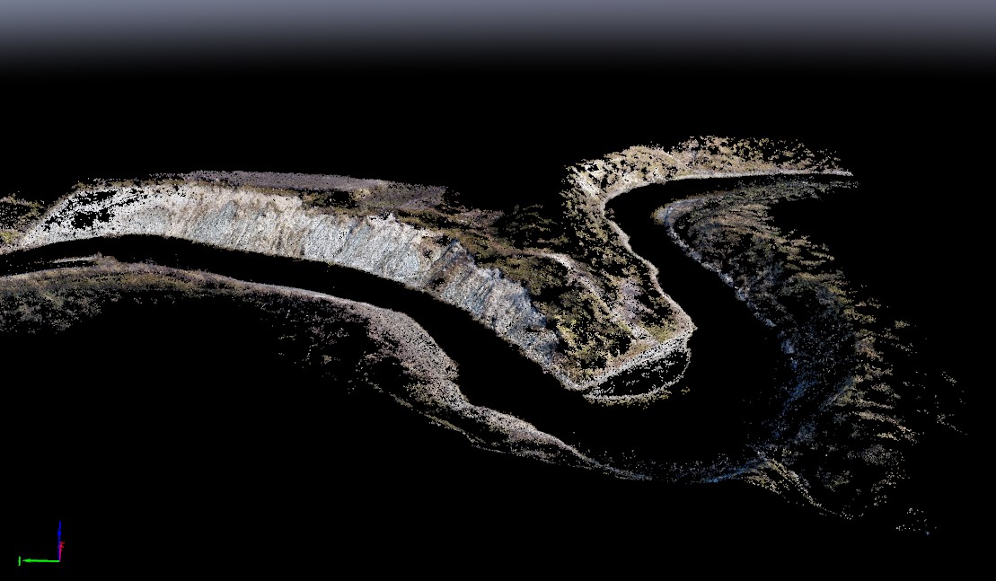
3D point cloud on the meander curve of the River Pulmanki produced by Structure-from-Motion method from aerial photo mosaic.
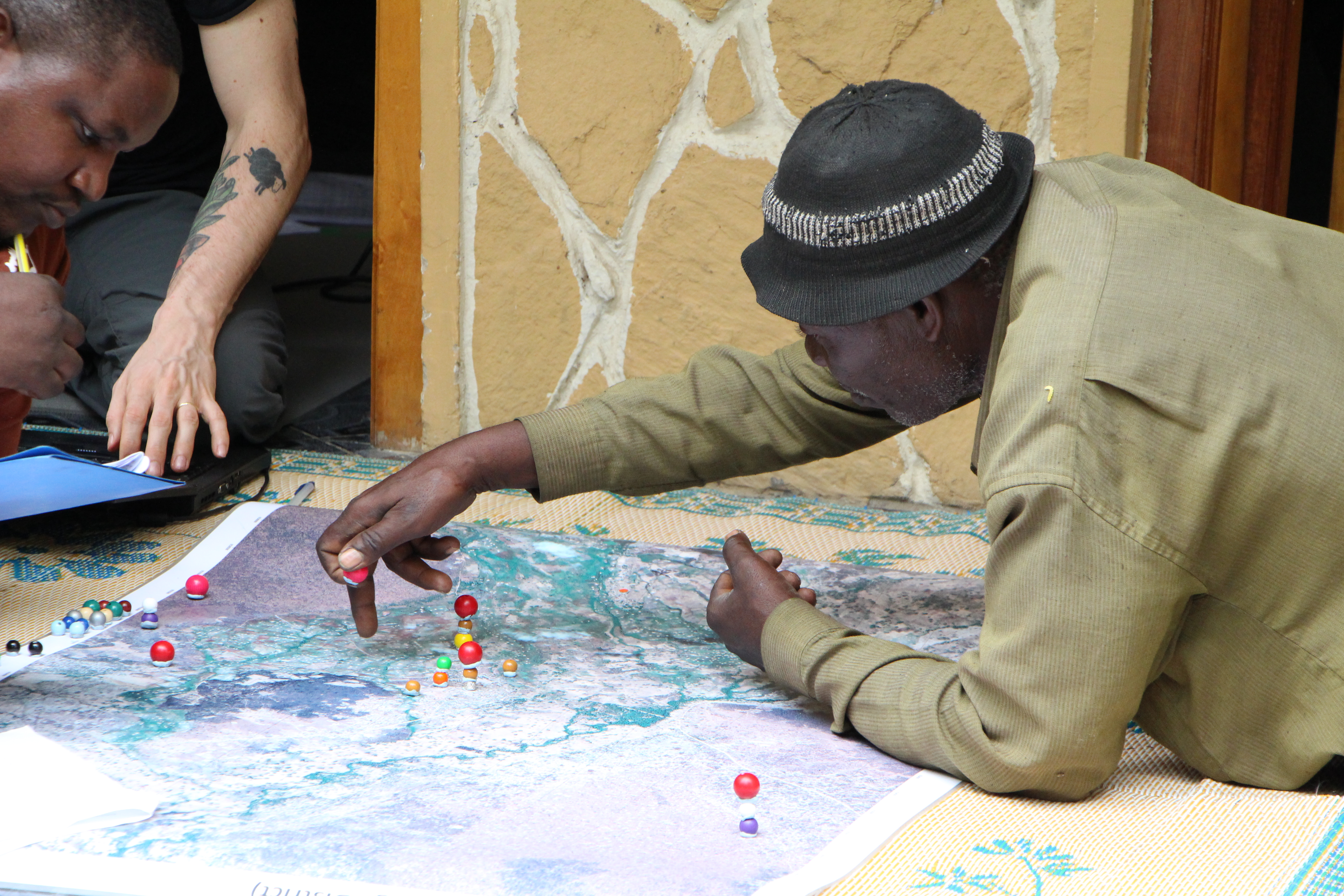
Participatory mapping of landscape services in the Tungamalenga village in the Tanzanian Southern Highlands.
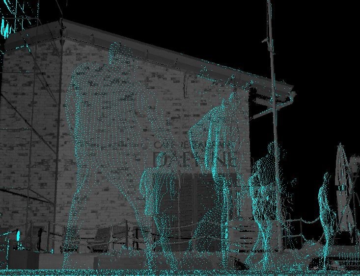
GeoHumanities approach to laser scanning. This image shows that when movement is laser scanned the results is a figure without resemblance.