Geospatial education is a balanced combination of theoretical and practical teaching, with hands-on skills training combined with scientific skills to model the world with geospatial data. While most of the geospatial teaching utilise open data and open-source software, we also provide specialised training using proprietary software, teach students to collect location-based data in the field, and search data sets via different repositories and archival sources.
Geospatial courses in Geography
Undergraduate courses are provided mainly by the Geography Section at the Faculty of Science. The courses introduce students broadly into the themes of geospatial data, methods and applications in today’s society. Courses at the BSc level give students basic scientific and practical knowledge of digital data sources, geospatial data management, analyses and visualization.
While basic-level teaching focuses on securing students’ technical and methodological skills, at the advanced level, students deepen their theoretical and conceptual skills, and focus on specific geospatial applications in the society. Multidisciplinary problem based learning is applied in various innovation and teamwork based courses, which gather students from different disciplines to solve location-related problems in the society. Increasingly, we link innovation and business education to real-world geospatial data and problems through capstone projects, Mapathons, Hackathlons and a like. Here, we build strong linkages of education to the needs of the society at large and to the possible employers of the graduates.
In addition to pure geospatial method courses, geospatial data, tools and methods are utilised in several thematic courses. In these courses, the students learn to apply their geospatial skills in their subject field studies, which simultaneously widens their thematic and geospatial thinking and skill set.
For more information about the courses, visit the Study Guide 2024–2027 in the Peppi system.
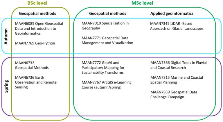
Specialization in Geospatial Research (MSc)
In Master’s level geography studies, the students may choose to specialise in geospatial topics. The geospatial module consists of the introductory course MAAN7010 Specialisation in Geography (5 ECTS) and other Master’s level geospatial courses up to 20 ECTS.
Through the personal coaching and well-planned implementation of the curricula, we encourage students to build themselves strong but also individualistic geospatial expertise profiles, which address current needs in the society and seek innovative research solutions for the future.
Geospatial courses in other disciplines
Besides the Geography Section, also other departments and disciplines provide teaching in the geospatial domain. Examples of geospatial method courses can be found in the fields of Economic geography, Ecology, Geology and Landscape studies:
EKOL4320 Spatial Biodiversity Informatics and Landscape Ecology
TM51/TJ17/LOG15 GIS in Business I
TMS51/TJS10 GIS in Business II
GEOL1125 Principles of 3D-modelling
GMIN3030 Geological 3D-modelling
KTMT1214 GIS Azalyzes and Their Use in Landscape Studies
DMKT1334 Methods of Experiential GIS
For more information about the courses, visit the Study Guide 2024–2027 in the Peppi system.
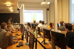
A presentation on online satellite image data services in the main GIS class.
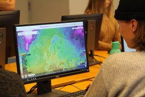
Getting familiar with online climate data services during the Methods in Remote Sensing course.
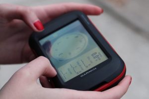
Handheld GPS devices are used in the Introduction to geoinformatics course
Collecting point data and attribute information in the Introduction to geoinformatics course.